Share our site:

SHARE
-
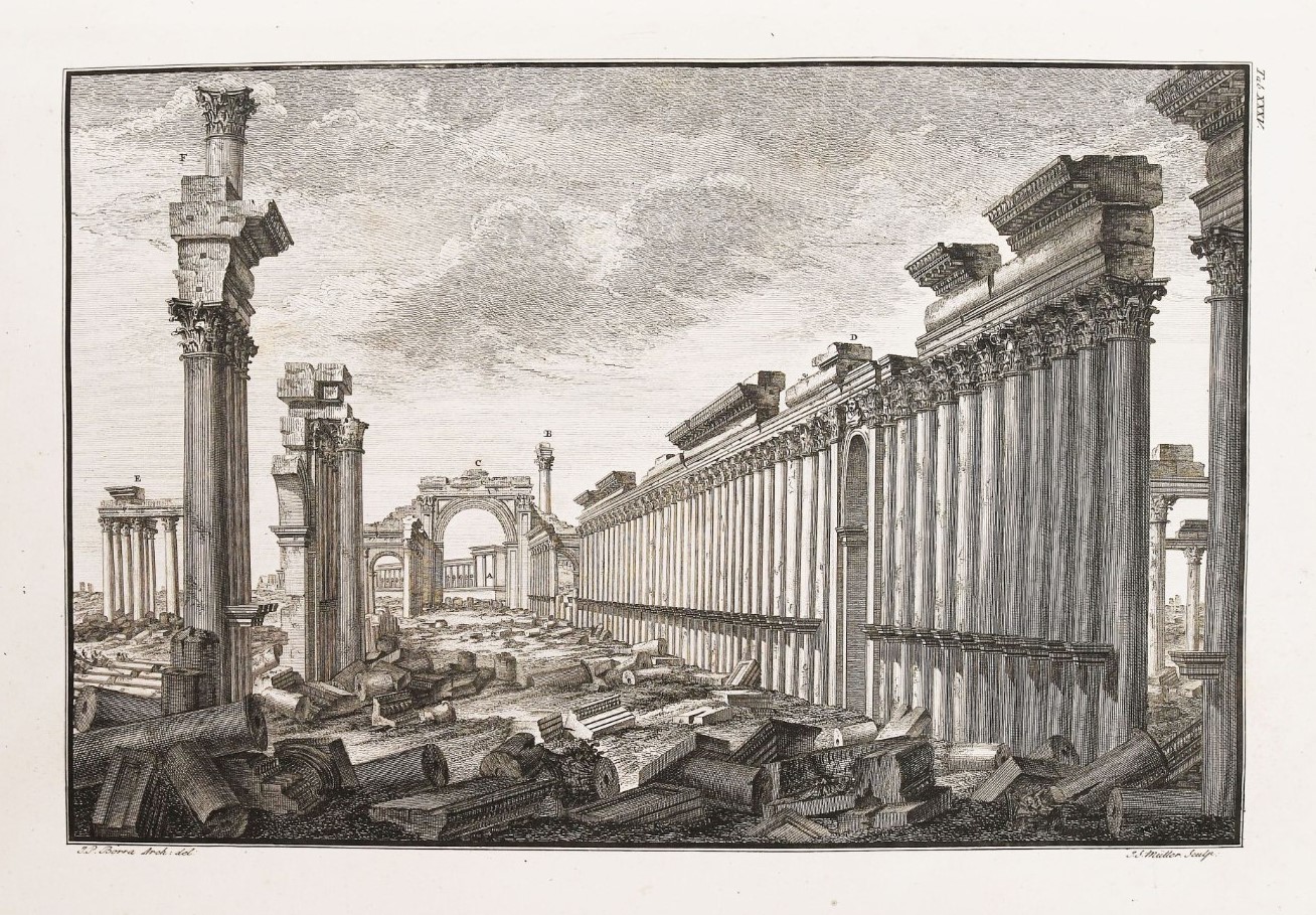 10th April 2024Rare Books, Prints, Autograph and Documents.Lot 151. WOOD. Les Ruines de Palmyre, autrement dite Tedmor, au Desert. Londres, A. Millar,
 -
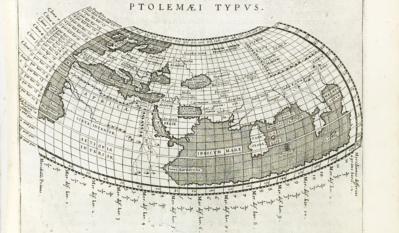 10th April 2024Rare Books, Prints, Autograph and Documents.Lot 64. PTOLEMAEUS. Geografia cioè descrittione universale della terra partita. 1597-98
 -
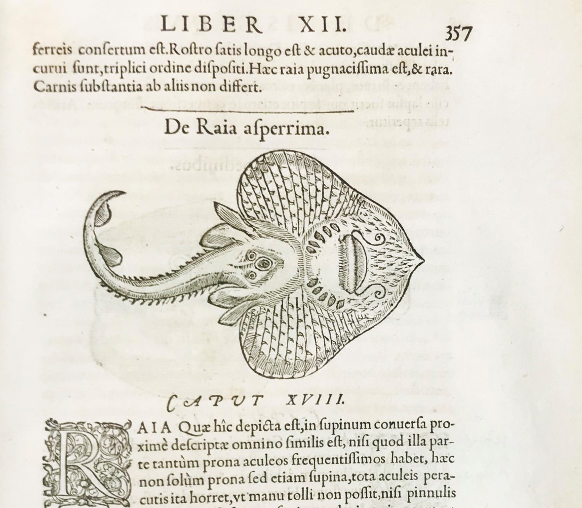 10th April 2024Rare Books, Prints, Autographs and Documents.Lot 40. RONDELET. Libri de Piscibus Marinis. Lyon, Mathias Bonhomme, 1554
 -
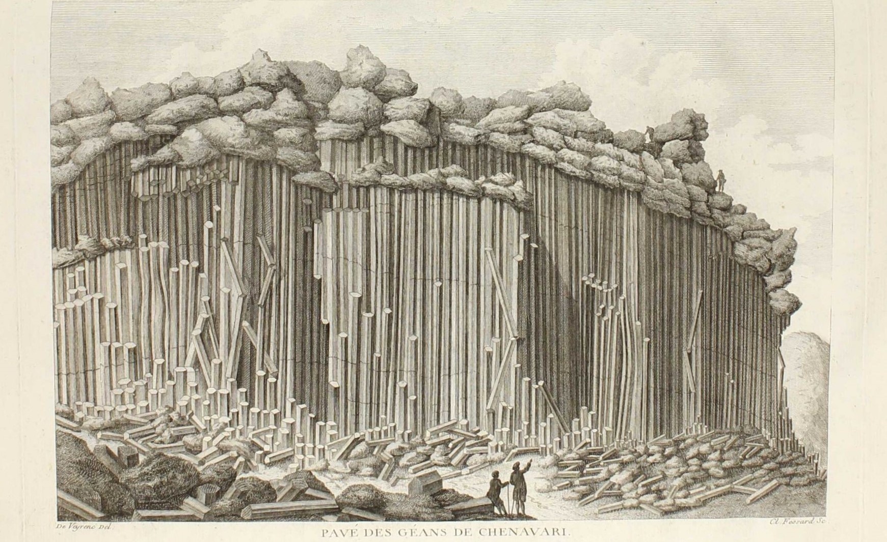 10th April 2024Rare Books, Prints, Autograph and Documents.Lot 183. FAUJAS DE SAINT-FOND. Recherches sur les volcans. 1778
 -
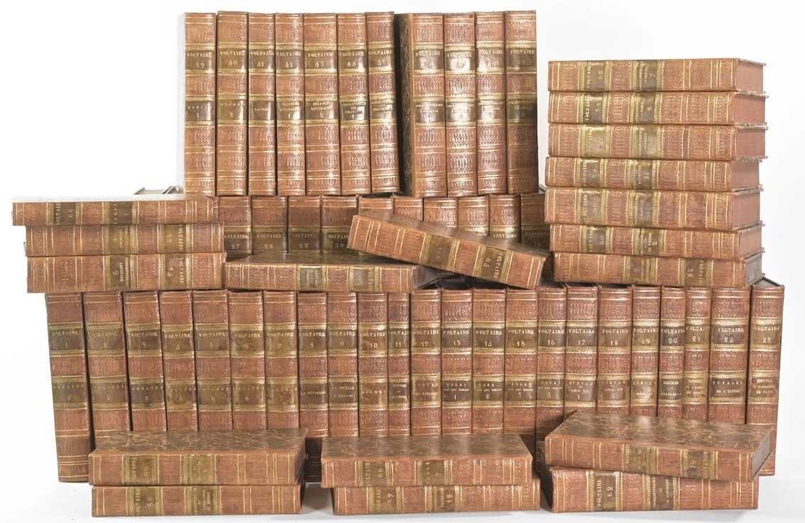 10th April 2024Rare Books, Prints, Autographs and Documents.Lot 251. VOLTAIRE. Oeuvres complètes. Paris, Renouard, Edition de Kehl, 1819-1825
Auction calendar
Bado e Mart Auctions
https://www.badoemart.it/img-footer/logo.png
Bado e Mart Auctions sas
Via Dei Soncin, 28
35122 Padova Veneto Italy
Tel. +39 049 8755317
Fax +39 049 8755317
E-mail: info@badoemart.it
VAT number IT00773300280
35122 Padova Veneto Italy
Tel. +39 049 8755317
Fax +39 049 8755317
E-mail: info@badoemart.it
VAT number IT00773300280
Follow us on
Copyright Bado e Mart Auctions 2018. All rights reserved.
Realized by Thetis Srl
Realized by Thetis Srl