Share our site:

SHARE
46
Atlas. MERCATOR - HONDIUS. Atlas Minor.
1648-51
EUR 10.000,00
Base d'asta
EUR 12.000,00 / 14.000,00
Stima
Descrizione
Atlas. MERCATOR - HONDIUS. Atlas Minor.
1648-51
1648-51
MERCATOR, Gerard - HONDIUS, Jodocus. Atlas Minor.
Amsterdam, J. Janssonius, 1648-1651
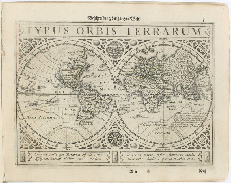
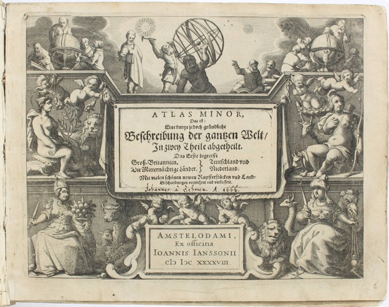
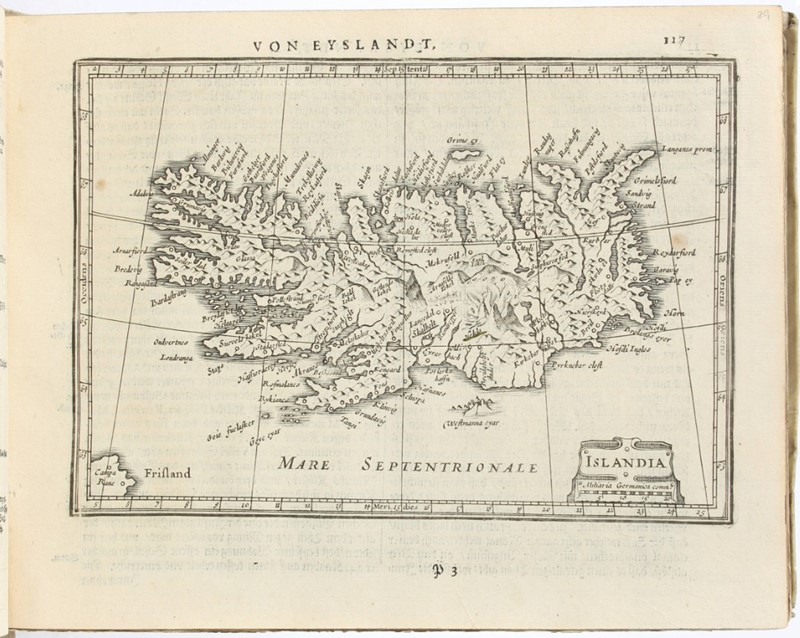
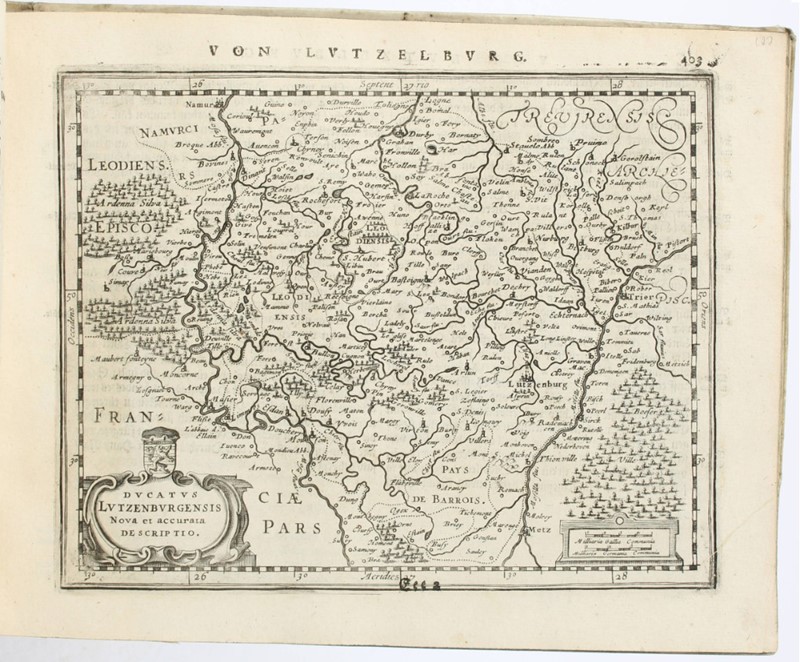
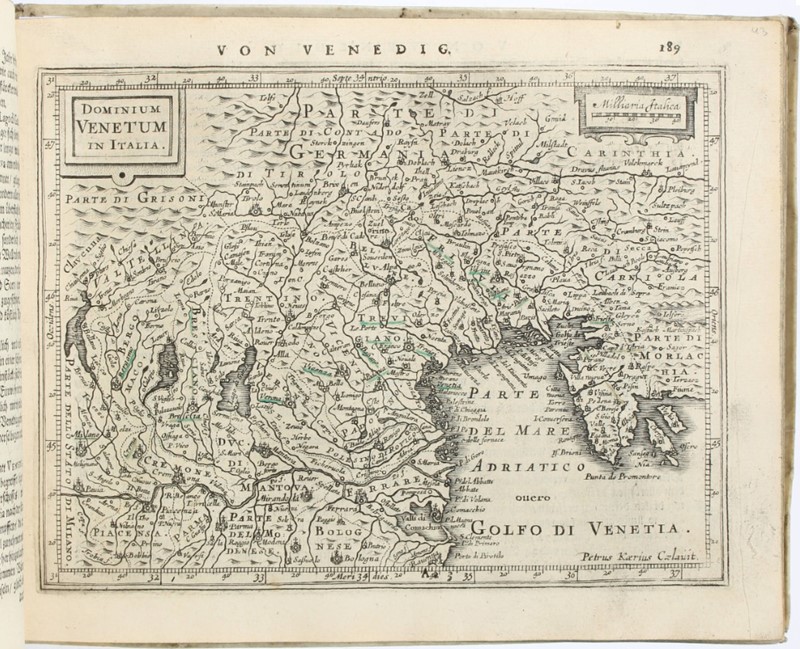
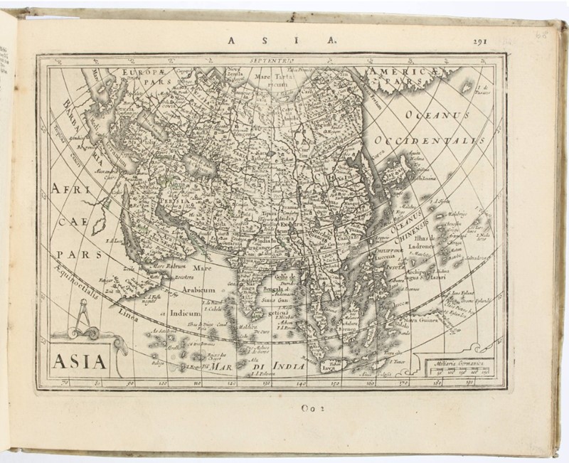
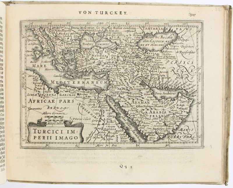
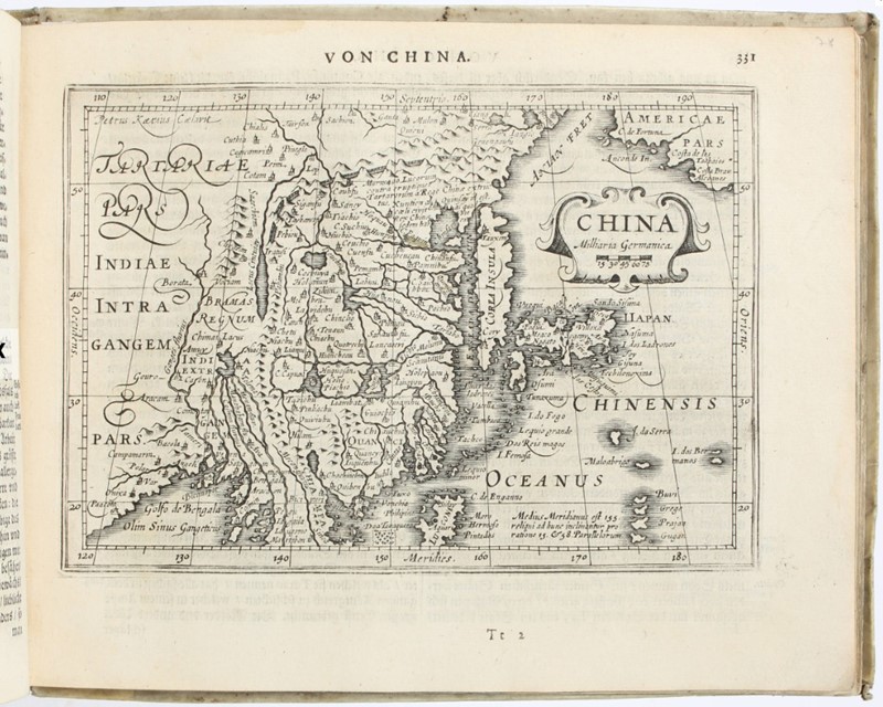
Bella e rara edizione tedesca del popolare atlante di piccolo formato del Mercator. Esemplare completo con la mappa di Kleve (fuori testo dopo p. 248 della prima parte), non presente in tutte le copie e non elencata da Koeman (ma presente da Van der Krogt). Le incisioni sono di Abraham Goos e Petrus Kaerius. La Parte I copre le Isole Britanniche, l'Europa settentrionale, la Germania e i Paesi Bassi; la Parte II copre Francia, Svizzera, Spagna, Italia, Asia, Africa e Americhe. Tra le splendide e numerose mappe di Abraham Goos e Petrus Kaerius si trovano una mappa del mondo in due emisferi, una mappa polare e mappe dei quattro continenti di Europa, Asia, Africa e Americhe, oltre a numerose mappe di dettaglio delle regioni sopra menzionate. Questa è la prima edizione dell’Atlas Minor in qui il nome di Mercator è stato omesso dal Frontespizio.
VD 17, 14:655906C; Phillips/L. 461; Koeman Me 203-4; Van der Krogt IIIB, 352:33.
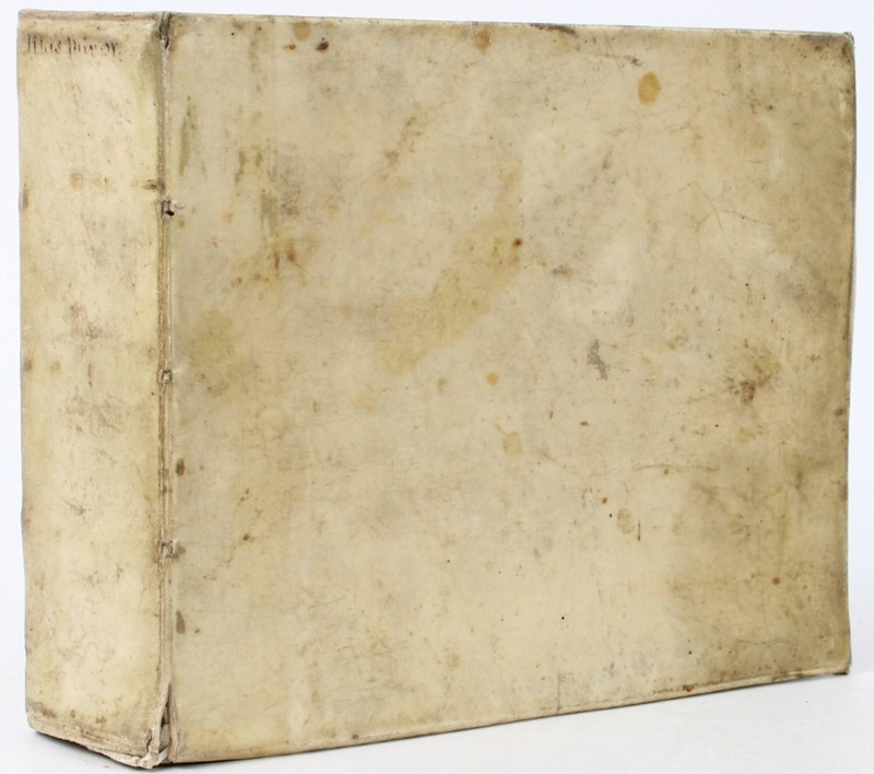
2 parti in un volume in 4to oblungo. 185x235 mm. Legatura coeva piena pergamena rigida con unghie, tagli azzurri. Pagine [12, compreso Frontespizio inciso], 460, [4, ultima bianca], 114 Carte Geografiche a piena pagina; Pagine [2, con Frontespizio inciso], 428, [2], 101 Carte Geografiche a piena pagina. Testo in tedesco su due colonne. Iscrizioni manoscritte di proprietà del XVII secolo sul primo frontespizio e sui risguardi anteriori.
In totale 2 Frontespizi figurati e 215 Carte geografiche a piena pagina, tutto inciso in rame. Lievissima brunitura, qualche piccola velatura di umidità e occasionali tracce d’uso, bell’esemplare genuino.
Condition Report
MERCATOR, Gerard - HONDIUS, Jodocus. Atlas Minor.
Amsterdam, J. Janssonius, 1648-1651
A beautiful and rare German edition of Mercator's popular small-format atlas. This complete copy includes the Kleve map (out of text after p. 248 of Part I), which is not present in all copies and is not listed by Koeman (but is present by Van der Krogt). The engravings are by Abraham Goos and Petrus Kaerius. Part I covers the British Isles, Northern Europe, Germany, and the Netherlands; Part II covers France, Switzerland, Spain, Italy, Asia, Africa, and the Americas. Among the numerous and splendid maps by Abraham Goos and Petrus Kaerius are a world map in two hemispheres, a polar map, and maps of the four continents of Europe, Asia, Africa, and the Americas, as well as numerous detailed maps of the aforementioned regions. This is the first edition of the Atlas Minor in which Mercator's name was omitted from the title page.
VD 17, 14:655906C; Phillips/L. 461; Koeman Me 203-4; Van der Krogt IIIB, 352:33.
Two parts in a volume in oblong 4to. 185x235 mm. Contemporary in full stiff vellum binding with squares, blue edges. Pp. [12, including the engraved title page], 460, [4, last blank], 114 geographical maps on full page; Pp [2, with engraved title page], 428, [2], 101 geographical maps on full pagw. German text on two columns. Handwritten notes of ownership of 17th binding on the first title page and on rear inside covers. In total two illustrated title pages and 215 engraved geographical maps on full page. Slight browning, some slight damp stain and occasional traces of wear; nice unsophisticated copy.
Bibliografia
VD 17, 14:655906C; Phillips/L. 461; Koeman Me 203-4; Van der Krogt IIIB, 352:33.
mar 9 Giugno 2026
Orari Asta
Via dei Soncin, 28
35122 PADOVA
ESIBIZIONE: 3-5 Giugno 2026 solo su appuntamento.
Per prenotare il vostro appuntamento chiamare il numero 049 8755317 o mandare una email a info@badoemart.it
Ricordiamo che il nostro staff rimane a vostra disposizione per eseguire condition report dettagliati con foto aggiuntive a quelle già presenti in catalogo.

Bado e Mart
https://www.badoemart.it/img-footer/logo.png
Bado e Mart Srl
Via Dei Soncin, 28
35122 Padova Veneto Italy
Tel. +39 049 8755317
Fax +39 049 8755317
E-mail: info@badoemart.it
Partita IVA IT00773300280
35122 Padova Veneto Italy
Tel. +39 049 8755317
Fax +39 049 8755317
E-mail: info@badoemart.it
Partita IVA IT00773300280
Follow us on
Copyright Bado e Mart 2018. All rights reserved.
Realized by Thetis Srl
Realized by Thetis Srl